Auckland waterfront
1883 (unknown photographer) – 2025
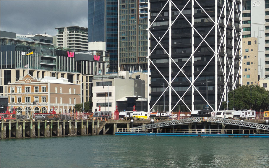
Drag the slider to compare two photographs
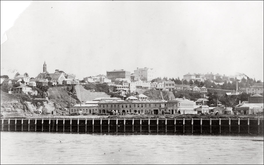
1883 image: Creator unknown: [The Auckland waterfront]. Ref: PAColl-8474. Alexander Turnbull Library, Wellington, New Zealand. /records/23103806
The foreground buildings in the 1883 image were on Customs Street East. The modern foreground buildings are on Quay Street (formed after the railway reclamation of 1879-1886) and thus the length of a city block closer to the camera position.
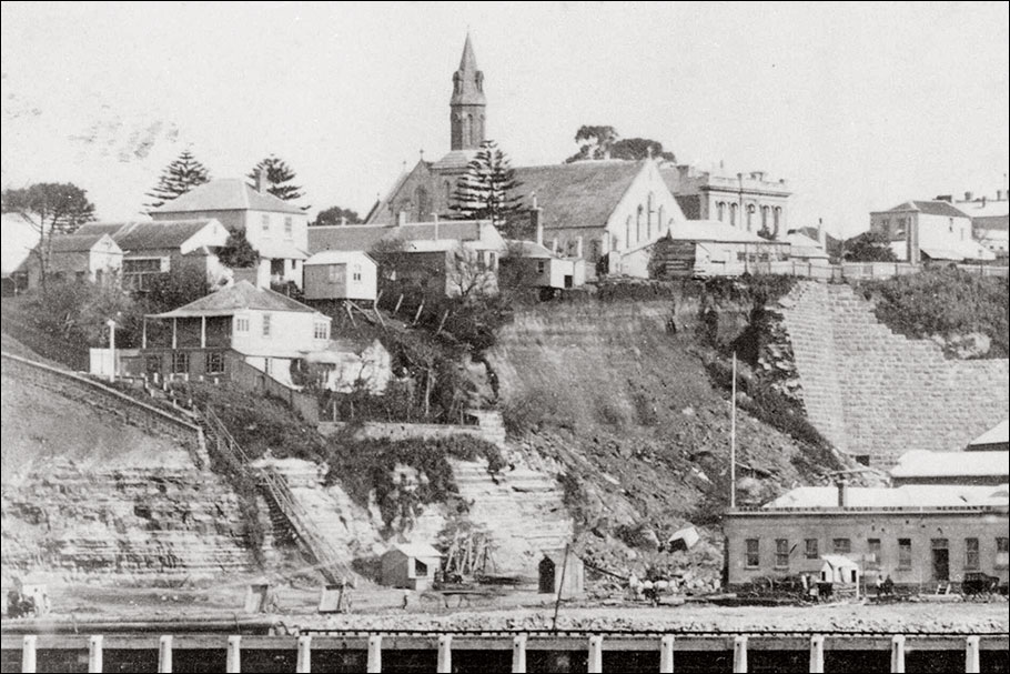
Below: This detail from the 1883 image shows at left the stairs (known as 'Jacob's Ladder') that led up from the end of Customs Street to Emily Place on the high ground of Point Britomart. At top-centre is old St Paul's church, which would be demolished in 1885.
But the most striking feature of this image—and a key to accurately dating it—is the catastrophic-looking landslide visible on the western side of Point Britomart above Fort Street, an event that took place shortly after midnight on 17 April 1883. For a full account of this incident see the newspaper report below. (Landslips—as they were termed in this period—seemed to be a common occurence around the flanks of Point Britomart during its lengthy demolition, but I think there can be little doubt that the one seen here is indeed the result of the April 1883 event.)
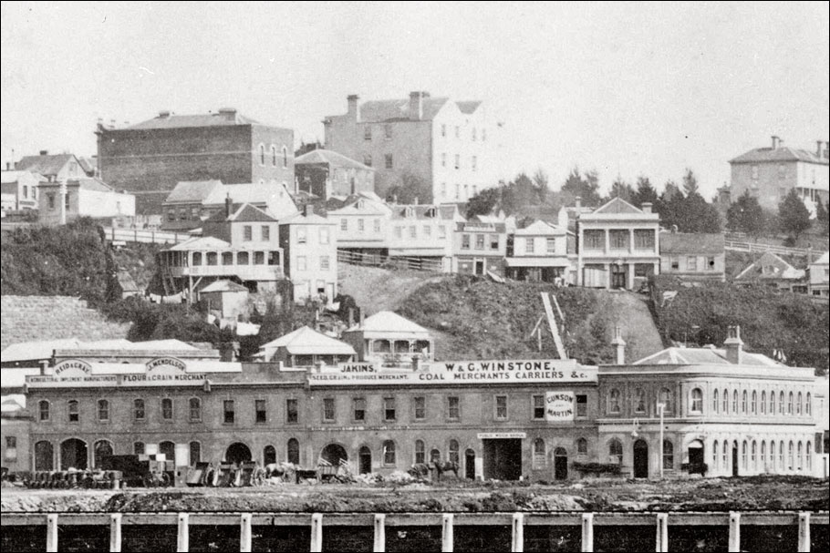
Below: Another detail from the 1883 image. The slope of Shortland Street crosses the picture at centre. The foreground building at left was a "fine new double store" built for Messrs Reid & Gray about a year earlier*. The building at right, the Britomart Hotel, is still standing in 2025.
Below: The New Zealand Herald's report on the landslide.
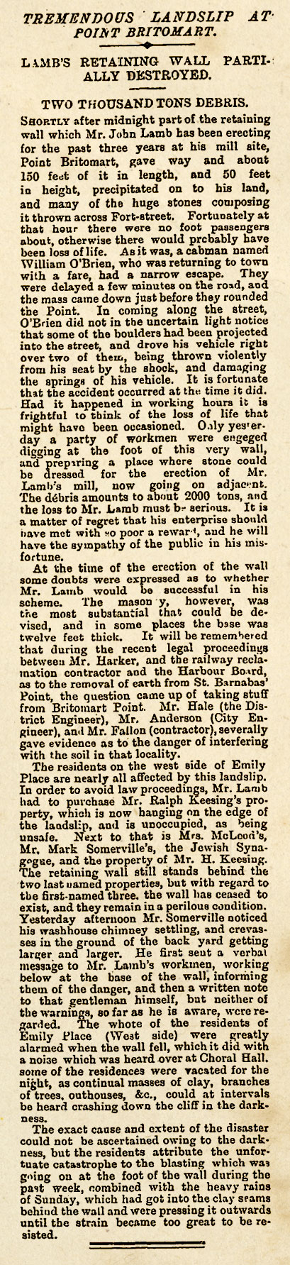
New Zealand Herald, 17 April 1883, page 5
*Auckland Star, 17 June 1882, page 2