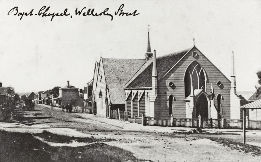
Baptist Church, Wellesley Street
1860s (GW Bishop) - 2025
Click on image to toggle transition between two photographs
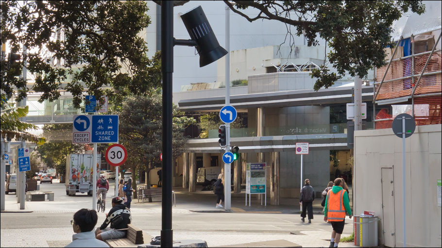
1860s image: GW Bishop | Auckland Libraries Heritage Collections 1691-015
Image comparison slider version
Click here for a fullscreen version of this transition.
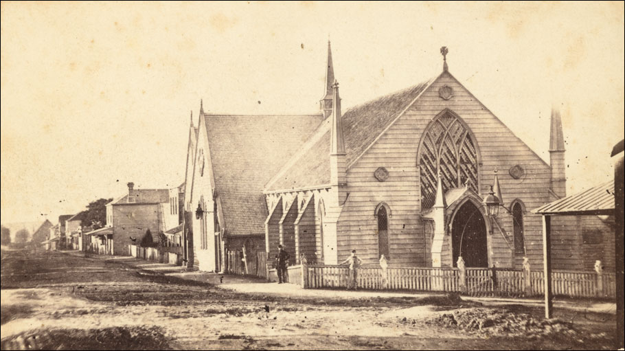
This Baptist church (often termed chapel) on the corner of Wellesley Street West (foreground) and modern Federal Street (then called Chapel Street) was built in 1857-8 and opened in February 1858 (see newspaper notice below).
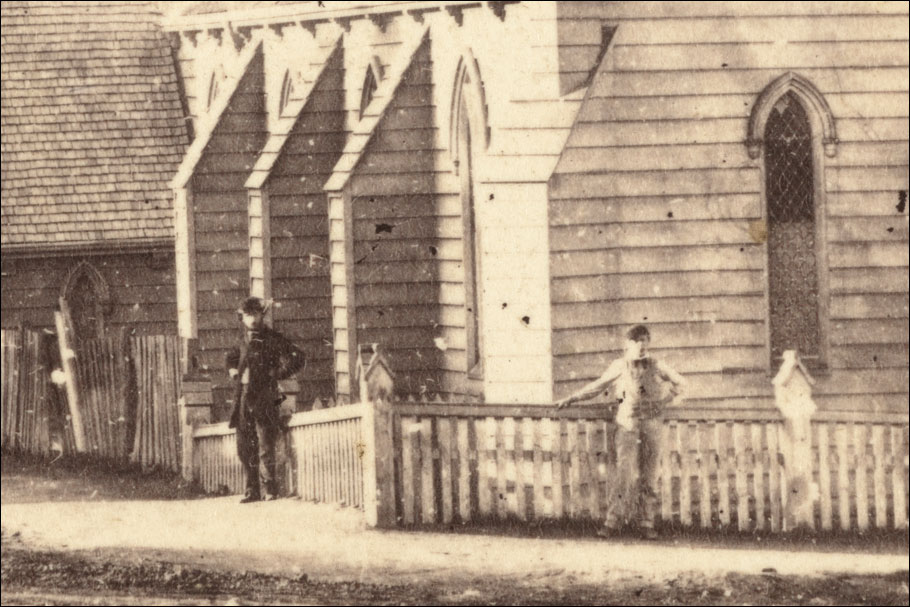
Below: A detail from Bishop's image.
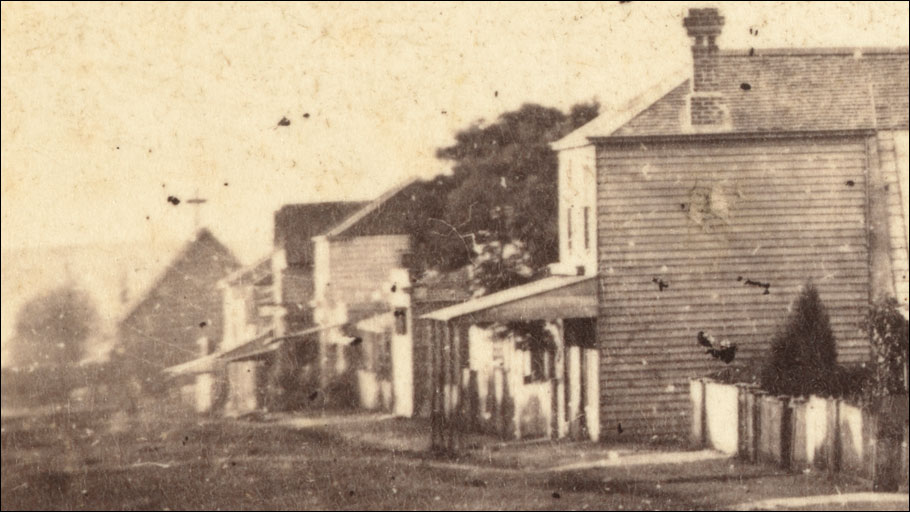
Below: From more or less the same period, another view of the church by an unknown photographer.
Baptist Chapel, Wellesley Street
Late 1850s - early 1860s(?) (unknown photographer) - 2025
Click on image to toggle transition between two photographs
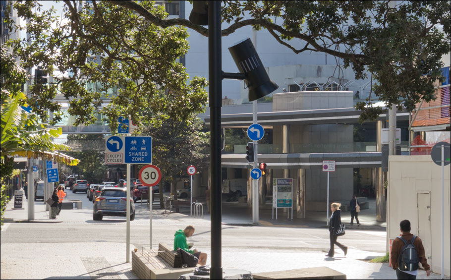
Historical image: unknown photographer | Auckland Libraries Heritage Collections 5-2661
Image comparison slider version
Click here for a fullscreen version of this transition, and here for a short animation of these images.
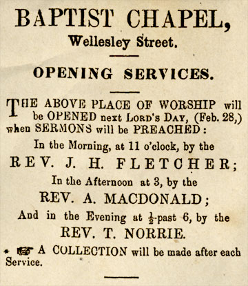
Daily Southern Cross, 23 February 1858, page 2
Written in stone
Don't believe everything you read, even if it's chiseled in stone. Below is a picture of an Auckland Council inscription set in the pavement on modern Federal Street beside the site of the old Baptist chapel.
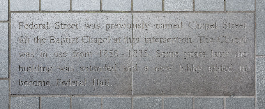
I too had thought that the street was named for the Baptist Chapel, but a little research suggests otherwise. It seems that the chapel for which the street was named was the Roman Catholic chapel at the northern end of the street, on the site where Saint Patrick's Cathedral now stands (there is a glimpse of it at the far end of Chapel Street in both of the 1860s photographs above; see detail below). An early reference to this appeared in the newspaper the New Zealander of 4 August 1847 (page 2) where, in an article about the nomenclature of geographical features and street naming, the anonymous editorialist wrote:
"We wish to inquire how it is, that some streets in Auckland have not yet received names? We give the street leading from the Roman Catholic Chapel as an instance. Some call it Chapel Street; others the unnamed street on the hill. . ."
From 1847, an advertisement for John Walker's business in Chapel Street:
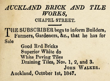
New Zealander, 2 October 1847, page 1
Below: By 1851 there was no longer any uncertainty about the name of the street: Chapel Street is named as such in this detail from Charles Heaphy's 1851 map of the city (seven years before the opening of the Baptist Chapel). The street runs from left to right at centre and the Roman Catholic Chapel (also named as such) can be seen at right. (This detail is rotated; north is approximately to the right.)
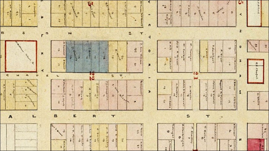
Auckland Libraries Heritage Collections Map 816 (detail)
Below: The Roman Catholic Chapel dominates the skyline at centre in this detail from an 1852 illustration of Auckland by Patrick Joseph Hogan.

Hogan, Patrick Joseph, 1804-1878: No. 3, Auckland, New Zealand (from Britomart Barrack). Ref: C-010-018. Alexander Turnbull Library, Wellington, New Zealand (detail).
Below: The Roman Catholic Chapel is seen at left in this detail from the 1860s image (1691_015) above.
The first Roman Catholic Chapel (dating from the early 1840s) was timber-built. The more substantial scoria church which replaced it, glimpsed in the 1860s images here, can be seen more clearly in another 1860s photograph, of Wyndham Street, here.
Click here for a then-and-now treatment of the Baptist church/chapel from the 1870s or '80s, and here for an 1880s Burton Brothers image. A then-and-now image pair showing the scene in 1925 is here.